Maps
| Name | Description | Project | Project Type | Document Date | Town |
|---|---|---|---|---|---|
|
|
PDM Aquinnah SLOSH map | Other | January 14, 2014 | ||
|
|
Map (b&w) of Skiff to Veteran's Park area as context for Skiff Rd bike improvements | Planning Project | September 14, 2012 | Tisbury (Vineyard Haven) | |
|
|
Environmental Sensitivity Index Map Edgartown Quadrangle | sensitivity of coastal environements and wildlife to spilled oil | Planning Project | February 25, 2005 | Edgartown |
|
|
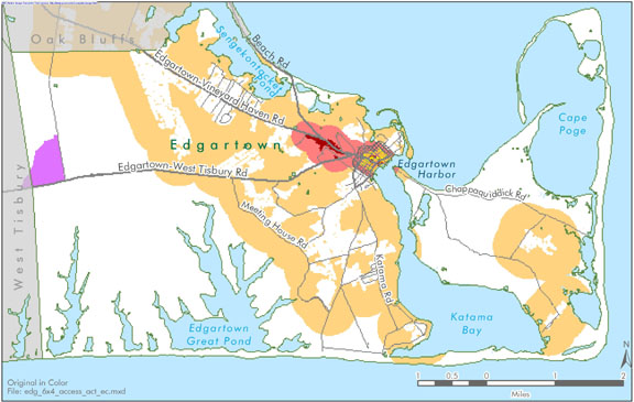
Edgartown map created for the existing conditions section of the Community Development Plan of 2004. | community development plan | Planning Project | October 23, 2006 | Edgartown |
|
|
Island-wide map created for the open space and natural resources section of the Community Development plan of 2004. | community development plan | Planning Project | October 27, 2006 | All-Island |
|
|
Island-wide map created for the economic section of the community development plan of 2004. | community development plan | Planning Project | October 27, 2006 | All-Island |
|
|
PDM Tisbury FIRM | pdm | Other | January 8, 2014 | Tisbury (Vineyard Haven) |
|
|
Hurricane inundation areas overlayed on parcel boundaries and aerial photo from 2009. | Other | August 26, 2011 | Tisbury (Vineyard Haven) | |
|
|
Zone II Hazards Map from Martha's Vineyard Source Water Assessment Project 2003 | m.v. source water protection project | Planning Project | June 8, 2004 | Edgartown |
|
|
Zoning Map of Tisbury, MA. PDF format 11x17 page size, full color. Map compiled in Aug. 2007 but data still current as of July 2015. See the town by-law for more details. This map is for planning purposes only and not for regulatory interpretation. | zoning maps | Other | August 28, 2007 | Tisbury (Vineyard Haven) |
|
|
Catch basin locations were GPSed by the MVC. The general storm water pipeline system is also mapped. This map is formatted for an 8x11 page. | Planning Project | January 7, 2015 | Tisbury (Vineyard Haven) | |
|
|
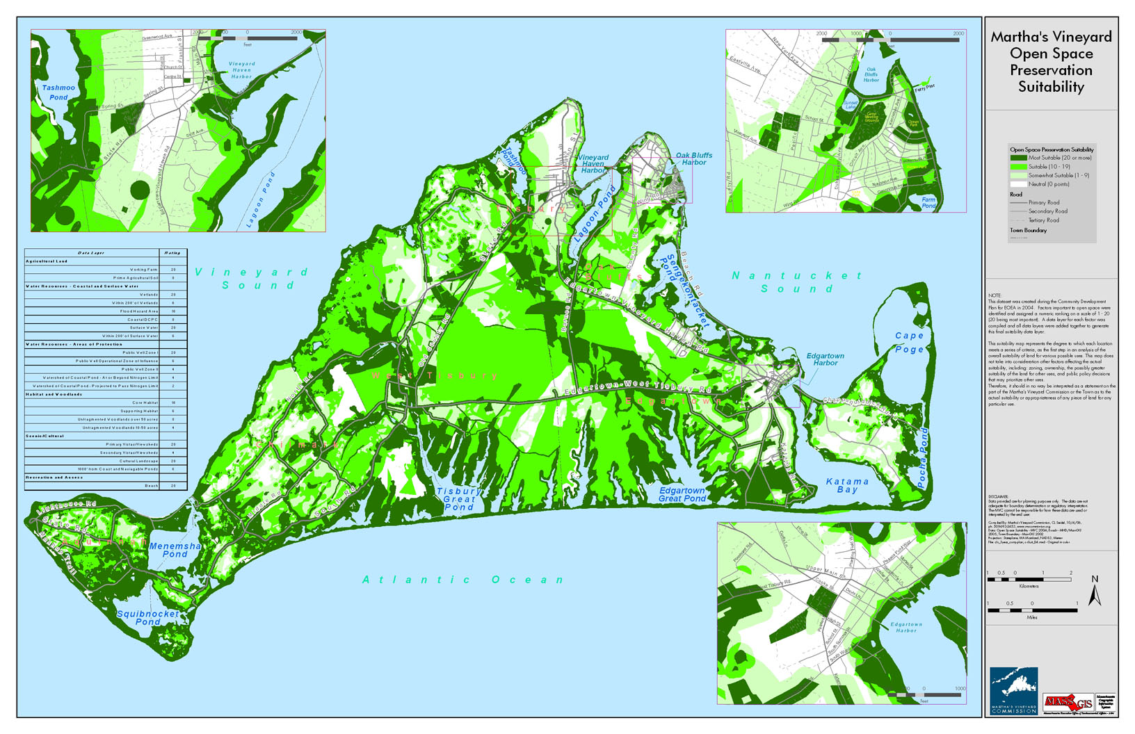
This dataset was created during the Community Development Plan for EOEA in 2004. Factors important to open space were identified and assigned a numeric ranking on a scale of 1 to 20 (20 being most important). A data layer for each factor was compiled and all data layers were added together to generate this final suitability data layer. | community development plan | Planning Project | October 4, 2006 | All-Island |
|
|
Edgartown map created for the economic suitability section of the Community Development Plan of 2004. | community development plan | Planning Project | October 23, 2006 | Edgartown |
|
|
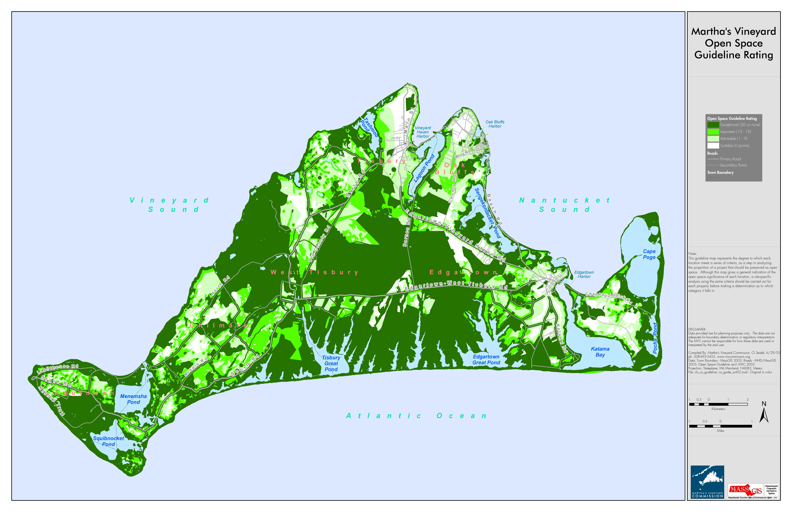
Based on various criteria, areas of MV were categorized to indicate areas ideal for open space preservation. Areas are categorized as either Suitable, Advisable, Important, or Exceptional (exceptional being the most ideal of open space preservation). | open space guideline | Planning Project | July 30, 2010 | All-Island |
|
|
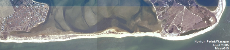
DRI 593 Aerial Overview | 18 state road | DRI | March 28, 2007 | Tisbury (Vineyard Haven) |
|
|
PDM Aquinnah FIRM map | Other | January 14, 2014 | Aquinnah (Gay Head) | |
|
|
Map showing proposed SUP from Wind's Up to Saltwater Restaurant | Planning Project | September 14, 2012 | All-Island | |
|
|
Environemntal Sensitivity Index Map Tisbury Great Pond Quadrangle | sensitivity of coastal environments and wildlife to spilled oil | Planning Project | February 25, 2005 | Chilmark |
|
|
Edgartown map created for the existing conditions section of the Community Development Plan of 2004. | community development plan | Planning Project | October 23, 2006 | Edgartown |
|
|
Island-wide map created for the housing section of the Community Development Plan of 2004. | community development plan | Planning Project | October 27, 2006 | All-Island |
Pages
Office location:
Office location:
The Stone Building
33 New York Avenue
Oak Bluffs, MA 02557
Telephone: 508-693-3453
Fax: 508-693-7894
Mailing Address
Mailing address:
Martha's Vineyard Commission
P.O. Box 1447
Oak Bluffs, MA 02557
About the MVC
Site Map
Copyright
© 2008 - 2026
Martha's Vineyard Commission
All Rights Reserved