
Maps
| Name | Description | Project | Project Type | Document Date | Town |
|---|---|---|---|---|---|
|
|
Small format guide designed for cyclists disembarking ferries in Vineyard Haven or Oak Bluffs | Planning Project | April 26, 2013 | ||
|
|
Parcels (as of 2008) overlaid on FEMA's 100 year and 500 year flood zones (as of 2010). | Other | February 7, 2013 | Edgartown | |
|
|
PDM Oak Bluffs SLOSH map | Other | January 14, 2014 | Oak Bluffs | |
|
|
land uses in the Zone II for the Farm Neck well, Oak Bluffs Water District | m.v. source water protection project | Planning Project | October 4, 2004 | Oak Bluffs |
|
|
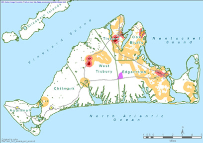
Major watershed boundaries (as of 2014) with respective pond water quality indicated. The watershed boundaries were compiled through the MassEstuaries program work conducted by SMAST and the MVC. The pond water quality is based on the Nitrogen loading level in the pond as ascertained from water quality data. This map was last updated in March of 2017. | Other | March 15, 2017 | All-Island | |
|
|
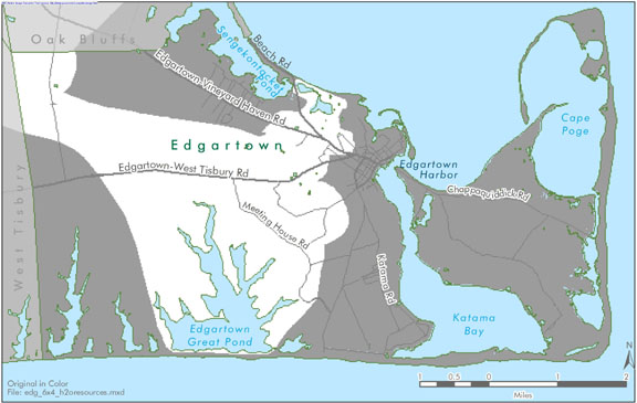
Edgartown map created for the water resources section of the Community Development Plan of 2004. | community development plan | Planning Project | October 23, 2006 | Edgartown |
|
|
Island-wide map created for the economic suitability section of the Community Development Plan of 2004. | community development plan | Planning Project | October 23, 2006 | All-Island |
|
|
Pocha Pond water quality sampling stations for resource assessment during 2005 | mv coastal pond water quality survey- summer 2005 | Planning Project | June 22, 2007 | Edgartown |
|
|
DRI 621 O.B. Harbor Gas Station MVC Aerial Overview | o.b. harbor gas station | DRI | May 19, 2009 | Oak Bluffs |
|
|
PDM Chilmark storm surge SLOSH map | pdm | Planning Project | January 14, 2014 | Chilmark |
|
|
DRI 582-M Vineyard House Modification Locus | vineyard house modification | DRI | October 19, 2011 | Tisbury (Vineyard Haven) |
|
|
Sengekontacket Pond water quality sampling stations for resource assessment during 2003 | mv coastal pond water quality survey: summer 2003 | Planning Project | June 15, 2005 | Edgartown |
|
|
Island-wide map created for the Open Space and Natural Resources section of the Community Development Plan of 2004. | community development plan | Planning Project | October 27, 2006 | All-Island |
|
|
Pamphlet of Martha's Vineyard's bike routes and safety tips. | Planning Project | April 26, 2013 | All-Island | |
|
|
Parcels (as of 2008) overlaid on FEMA's 100 year and 500 year flood zones (as of 2010). | Other | February 7, 2013 | Chilmark | |
|
|
PDM Oak Bluffs Sea Level Rise map | Other | January 14, 2014 | Oak Bluffs | |
|
|
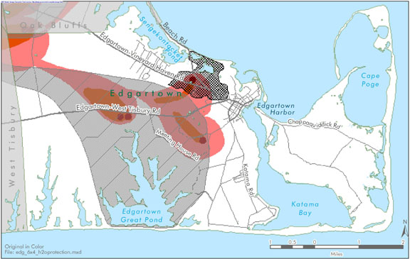
land uses within the Wintucket-Quenomica Zone II, Town of Edgartown | m.v. source water protection project | Planning Project | October 4, 2004 | Edgartown |
|
|
DRI 621-M Oak Bluffs Harbor Fueling Facility - Locus map | Other | March 1, 2013 | Oak Bluffs | |
|
|
Edgartown map created for the housing suitability section of the Community Development Plan of 2004. | community development plan | Planning Project | October 23, 2006 | Edgartown |
|
|
Edgartown town map created for the existing conditions section of the Community Development Plan of 2004 | community development plan | Planning Project | October 23, 2006 | Edgartown |
Pages
Office location:
Office location:
The Stone Building
33 New York Avenue
Oak Bluffs, MA 02557
Telephone: 508-693-3453
Fax: 508-693-7894
Mailing Address
Mailing address:
Martha's Vineyard Commission
P.O. Box 1447
Oak Bluffs, MA 02557
About the MVC
Site Map
Copyright
© 2008 - 2026
Martha's Vineyard Commission
All Rights Reserved