Maps
| Name | Description | Project | Project Type | Document Date | Town |
|---|---|---|---|---|---|
|
|
Other | July 23, 2004 | All-Island | ||
|
|
Hurricane inundation areas overlayed on parcel boundaries and aerial photo from 2009. | Other | August 26, 2011 | West Tisbury | |
|
|
Trail map, created by The Nature Conservancy, of their Hoft Farm property. | Other | April 3, 2014 | Tisbury (Vineyard Haven) | |
|
|
Water Resource Assessment Stations - Farm Pond - for sampling year 2004 | Other | October 18, 2006 | Oak Bluffs | |
|
|
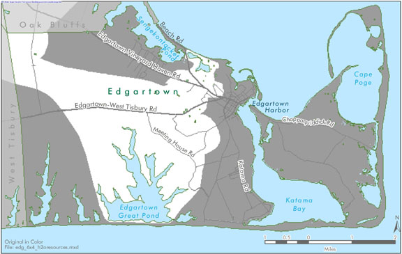
Edgartown map created for the housing suitability section of the Community Development Plan of 2004. | community development plan | Planning Project | October 23, 2006 | Edgartown |
|
|
Oyster Pond water quality sampling stations for resource assessment during 2005 | mv coastal pond water quality survey- summer 2005 | Other | June 22, 2007 | Edgartown |
|
|
Compiled in May of 2014 using road data from MassDOT year 2012. All streets are labeled and a street name look up table with corresponding map index info is provided. The download document includes 4 maps and the look-up table all bundled into one PDF file. | Other | May 18, 2014 | West Tisbury | |
|
|
PDM Edgartown Sea Level Rise map | Other | January 14, 2014 | Edgartown | |
|
|
DRI 584 - Cozy Hearth Plot Plan | cozy hearth | DRI | May 12, 2005 | Edgartown |
|
|
Map (b&w) of Skiff to Veteran's Park area as context for Skiff Rd bike improvements | Planning Project | September 14, 2012 | Tisbury (Vineyard Haven) | |
|
|
Edgartown map created for the housing section of the Community Development Plan of 2004. | community development plan | Planning Project | October 23, 2006 | Edgartown |
|
|
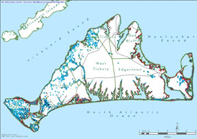
Island-wide map created for the open space and natural resources section of the Community Development Plan of 2004. | community development plan | Planning Project | October 27, 2006 | All-Island |
|
|
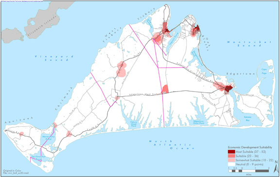
Island-wide map created for the economic section of the Community Development Plan of 2004. | community development plan | Planning Project | October 27, 2006 | All-Island |
|
|
The hurricane surge inundation areas shown on this map depict the inundation that can be expected to result from a worst case combination of hurricane landfall location, forward speed, and direction for each hurricane category. | Other | July 5, 2013 | West Tisbury | |
|
|
Color map - E size | Other | July 23, 2004 | Oak Bluffs | |
|
|
Hurricane inundation areas overlayed on parcel boundaries and aerial photo from 2009. | Other | August 26, 2011 | Tisbury (Vineyard Haven) | |
|
|
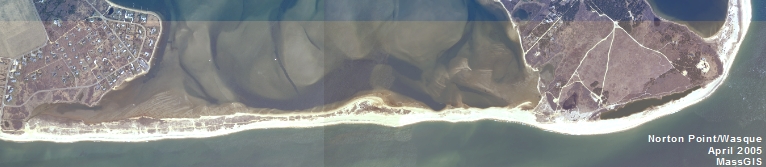
Trustees of Reservations property map for Wasque & Cape Poge Reservations. | Other | April 3, 2014 | Edgartown | |
|
|
Water Resource Assessment Stations - Tashmoo Pond - for sampling year 2004 | Other | October 18, 2006 | Tisbury (Vineyard Haven) | |
|
|
Edgartown map created for the open space & natural resources section of the Community Development Plan of 2004. | community development plan | Planning Project | October 23, 2006 | Edgartown |
|
|
James Pond water quality sampling stations for resource assessment during 2005 | mv coastal pond water quality survey- summer 2005 | Planning Project | June 22, 2007 | West Tisbury |
Pages
Office location:
Office location:
The Stone Building
33 New York Avenue
Oak Bluffs, MA 02557
Telephone: 508-693-3453
Fax: 508-693-7894
Mailing Address
Mailing address:
Martha's Vineyard Commission
P.O. Box 1447
Oak Bluffs, MA 02557
About the MVC
Site Map
Copyright
© 2008 - 2026
Martha's Vineyard Commission
All Rights Reserved