Maps
| Name | Description | Project | Project Type | Document Date | Town |
|---|---|---|---|---|---|
|
|
Other | July 23, 2004 | All-Island | ||
|
|
Map of parcels potentially affected (shown in grey) and not affected (shown in white) by the DRI geographic triggers. If a parcel does fall within a geographic trigger, the user must then refer to the DRI Checklist to determine if the project must be referred to the Martha's Vineyard Commission for review. These maps were prepared with the best information available to the MVC and as carefully as possible. However, the building inspector or town board dealing with the application should check this information and may have local knowledge that was not mapped. | Other | April 11, 2013 | Edgartown | |
|
|
Water Resource Assessment Stations - Farm Pond - for sampling year 2004 | Other | October 18, 2006 | Oak Bluffs | |
|
|
PDM Aquinnah Sea Level Rise map | Other | January 14, 2014 | Aquinnah (Gay Head) | |
|
|
Parcels (as of 2008) overlaid on FEMA's 100 year and 500 year flood zones (as of 2010). | Other | February 7, 2013 | Oak Bluffs | |
|
|
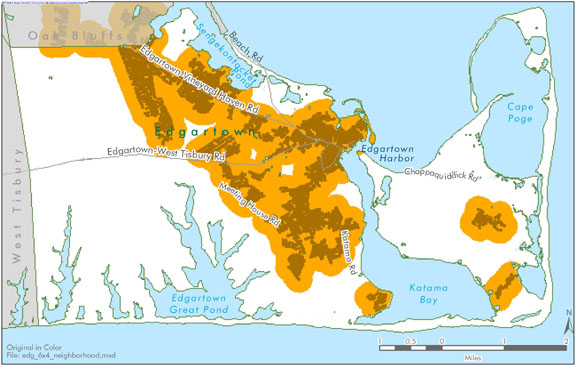
Edgartown map created for the open space & natural resources section of the Community Development Plan of 2004. | community development plan | Planning Project | October 23, 2006 | Edgartown |
|
|
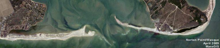
Katama Bay water quality sampling stations for resource assessment during 2005 | mv coastal pond water quality survey- summer 2005 | Planning Project | June 22, 2007 | Edgartown |
|
|
DRI 582 - Vineyard House Site Plan 2005 | dri 582 - vineyard gardens site plan | DRI | June 10, 2005 | Tisbury (Vineyard Haven) |
|
|
PDM Tisbury Wildland Urban Interface | pdm | Other | January 8, 2014 | Tisbury (Vineyard Haven) |
|
|
Edgartown map created for the 3 Open Space and Natural Resources section of the Community Development Plan of 2004. | community development plan | Planning Project | October 23, 2006 | Edgartown |
|
|
Map compiled in June 2009 using Navteq road data from 2008. | Other | June 24, 2009 | Chilmark | |
|
|
Catch basin locations were GPSed by the MVC. The general storm water pipeline system is also mapped. | Planning Project | January 7, 2015 | Chilmark | |
|
|
Map of Shared Use Paths on Martha's Vineyard | Other | July 26, 2012 | All-Island | |
|
|
Island-wide map created for the housing section of the Community Development Plan of 2004. | community development plan | Planning Project | October 27, 2006 | All-Island |
|
|
Color map - E size | Other | July 23, 2004 | Oak Bluffs | |
|
|
Map of parcels potentially affected (shown in grey) and not affected (shown in white) by the DRI geographic triggers. If a parcel does fall within a geographic trigger, the user must then refer to the DRI Checklist to determine if the project must be referred to the Martha's Vineyard Commission for review. These maps were prepared with the best information available to the MVC and as carefully as possible. However, the building inspector or town board dealing with the application should check this information and may have local knowledge that was not mapped. | Other | April 11, 2013 | Oak Bluffs | |
|
|
Water Resource Assessment Stations - Tashmoo Pond - for sampling year 2004 | Other | October 18, 2006 | Tisbury (Vineyard Haven) | |
|
|
PDM Aquinnah Wildland-urban Interface map | Other | January 14, 2014 | Aquinnah (Gay Head) | |
|
|
CR 3 - 2011 Goodale Pit NHESP Maps | goodale pit | DRI | May 20, 2011 | Oak Bluffs |
|
|
Edgartown map created for the housing suitability section of the Community Development Plan of 2004. | community development plan | Other | October 27, 2006 | Edgartown |
Pages
Office location:
Office location:
The Stone Building
33 New York Avenue
Oak Bluffs, MA 02557
Telephone: 508-693-3453
Fax: 508-693-7894
Mailing Address
Mailing address:
Martha's Vineyard Commission
P.O. Box 1447
Oak Bluffs, MA 02557
About the MVC
Site Map
Copyright
© 2008 - 2026
Martha's Vineyard Commission
All Rights Reserved