Maps
| Name | Description | Project | Project Type | Document Date | Town |
|---|---|---|---|---|---|
|
|
PDM Tisbury Wildland Urban Interface | pdm | Other | January 8, 2014 | Tisbury (Vineyard Haven) |
|
|
Parcels (as of 2008) overlaid on FEMA's 100 year and 500 year flood zones (as of 2010). | Other | February 7, 2013 | Chilmark | |
|
|
Catch basin locations were GPSed by the MVC. The general storm water pipeline system is also mapped. | Planning Project | January 7, 2015 | Chilmark | |
|
|
DRI 621-M Oak Bluffs Harbor Fueling Facility - Locus map | Other | March 1, 2013 | Oak Bluffs | |
|
|
Island-wide map created for the housing section of the Community Development Plan of 2004. | community development plan | Planning Project | October 27, 2006 | All-Island |
|
|
Pocha Pond water quality sampling stations for water resource assessment during 2003 | mv coastal pond water quality survey- summer 2003 | Planning Project | June 15, 2005 | Edgartown |
|
|
Small format guide designed for cyclists disembarking ferries in Vineyard Haven or Oak Bluffs | Planning Project | April 26, 2013 | ||
|
|
DRI 613 Hoehn Bldg Locus Map | hoehn bldg | DRI | April 25, 2008 | Tisbury (Vineyard Haven) |
|
|
The map displays water resource assessment stations in Katama Bay where water quality samples were collected during 2007 | mv water quality survery: summer 2007 | Planning Project | June 18, 2009 | Edgartown |
|
|
PDM Oak Bluffs SLOSH map | Other | January 14, 2014 | Oak Bluffs | |
|
|
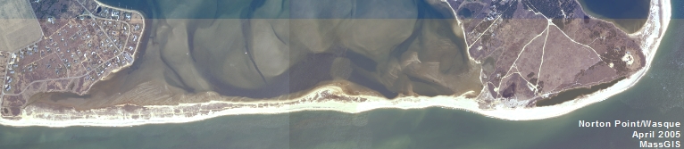
GPS collected shoreline & cliff data of Wasque point from June of 2012 overlayed on 2005 aerial photo. | wasque mapping | Planning Project | July 11, 2012 | Edgartown |
|
|
Edgartown map created for the housing suitability section of the Community Development Plan of 2004. | community development plan | Planning Project | October 23, 2006 | Edgartown |
|
|
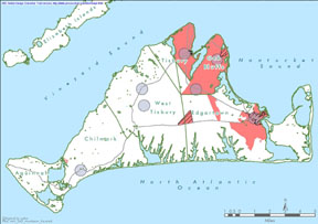
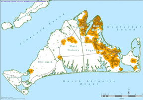
Environmental Sensitivity Index Map Naushon Island | sensitivity of coastal environments and wildlife to spilled oil | Planning Project | February 25, 2005 | Chilmark |
|
|
Farm Pond water quality sampling stations for resource assessment during 2003 | mv coastal pond water quality survey- summer 2005 | Planning Project | June 22, 2007 | All-Island |
|
|
Edgartown map created for the existing conditions section of the Community Development Plan of 2004. | community development plan | Planning Project | October 23, 2006 | Edgartown |
|
|
PDM Chilmark storm surge SLOSH map | pdm | Planning Project | January 14, 2014 | Chilmark |
|
|
Parcels (as of 2008) overlaid on FEMA's 100 year and 500 year flood zones (as of 2010). | Other | February 7, 2013 | Aquinnah (Gay Head) | |
|
|
DCPC Coastal District Oak Bluffs map | DCPC | March 27, 2013 | Oak Bluffs | |
|
|
Island-wide map created for the housing section of the community development plan of 2004. | community development plan | Planning Project | October 27, 2006 | All-Island |
|
|
Water Resource Assessment Stations - Chilmark Pond - for sampling year 2004 | 604b04 | Planning Project | September 29, 2006 | Chilmark |
Pages
Office location:
Office location:
The Stone Building
33 New York Avenue
Oak Bluffs, MA 02557
Telephone: 508-693-3453
Fax: 508-693-7894
Mailing Address
Mailing address:
Martha's Vineyard Commission
P.O. Box 1447
Oak Bluffs, MA 02557
About the MVC
Site Map
Copyright
© 2008 - 2026
Martha's Vineyard Commission
All Rights Reserved